The Treaty of Rio
On May 5, 1906, the boundary treaty was signed in Rio de Janeiro between the Netherlands and Brazil. It established the border along the watershed of the Tumuk Humak Mountains.
"This treaty created a 'dry border': not a single river crosses the boundary line, minimizing smuggling and territorial confusion."
The Southern Border: A Timeline
From diplomatic agreement to physical marking in the jungle.
1906
Treaty of Rio
The Netherlands and Brazil sign the boundary treaty in Rio de Janeiro.
Significance: The legal basis for the current border line.
1936
Tri-junction Point
The boundary commission establishes the point where the borders of Brazil, Suriname, and Guyana meet.
Significance: A crucial point at the source of the Kutari River.
1938
Käyser Final Report
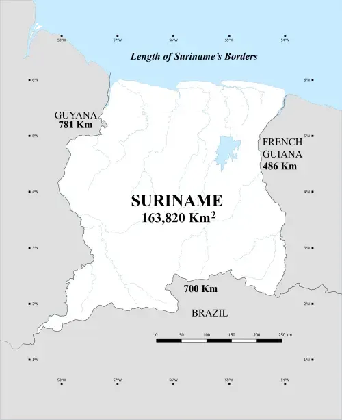
The mixed commission completes the physical marking of the border (593 km).
Significance: The final confirmation of boundary markings in the field.
Our Stance:
"A border that follows the natural logic of the landscape is a border that stands the test of time."
Consulted Sources
In Search of Suriname's Southern Border
A.J.H. van Lynden (1939). A historical account of the expeditions to the southern border of Suriname. Digitized by Delpher.
1906 Boundary Treaty
The official treaty between the Netherlands and Brazil establishing the border line.
Suriname Topographical Service
Cartographic data and boundary descriptions from the colonial period.
National Archives
Historical documentation regarding the boundary commission led by Käyser.